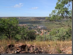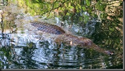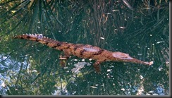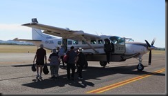
6th June 2017–Katherine to Daly Waters

Distance: 295 km
Fuel: 33 L

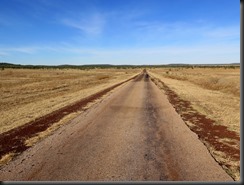
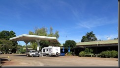
Left the caravan park at about 8.30am and headed straight down the Stuart Highway to Daly Waters, very much in familiar territory now. Didn’t stop at any of the many ‘historic’ WWII airfields or hospitals because I did so last time I was down this way. Anyway most of the airfields have just been reclaimed by the bush and are barely visible

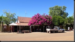
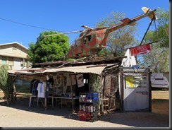
Last time I was here I stayed at the Hi-Way Motel so this time decided to stay at the Daly Waters Pub Caravan Park. I thought it would be quieter than the roadhouse. Nope! from when I arrived at about midday there was a continuous stream of campers and vans filling the place up. The pub was doing a roaring trade.

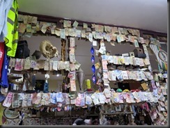
170606 028 Daly Waters Pub170606 030 Daly Waters Pub170606 032 Daly Waters Pub170606 048  Daly Waters Pub170606 033 Daly Waters Pub170606 035 Daly Waters Pub

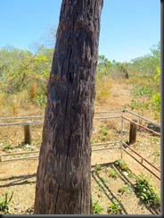
Revisited the Stuart Tree – you can just vaguely make out the ‘S’ carved in it.

170606 006 Daly Waters Stuart Tree170606 008 Daly Waters Stuart Tree

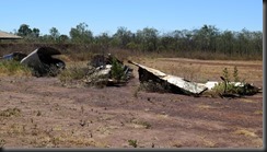
Also had a look at the Daly Waters Airstrip once a fairly busy hub, it claims to have been a ‘complex’ especially leading up to and during WWII but now just another bush landing strip though with a tarmac surface.

170606 011 Daly Waters Airstrip170606 012 Daly Waters Airstrip170606 010 Daly Waters Airstrip170606 019 Daly Waters Airstrip170606 020 Daly Waters Airstrip170606 021 Daly Waters Airstrip

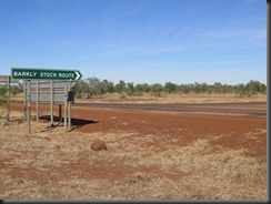
Am stopped here because I have decided to get off the Stuart Highway and take a detour to the Barkly Highway via the Carpentaria and Tablelands Highways instead of continuing down to the Threeways Roadhouse and getting on the Barkly there.

I had a couple of beers or six at the pub ($8 a schooner!) but they have a happy hour at 5pm to 6pm which I tested – $4 midis. Afterwards I ordered their kangaroo steak which was surprisingly good and well priced.

170606 050  Daly Waters Pub Meal

Tomorrow I plan to stop at Cape Crawford and this journey is about 100km longer than staying on the Stuart but I have never been there before (road less travelled and that).These highways are sealed but a single lane so oncoming trucks have to be treated with a lot of respect (ie you take to the dirt). BTW ‘Cape Crawford’ sounds nautical but it is actually about 140km inland from the Gulf of Carpentaria.

5th June 2017–Katherine Day One

Distance: 23 km

Had a change of heart and decided to stay in Katherine for an extra day so I did some laundry then rolled up at the office when it opened to pay for the extra day and buy a bag of ice.

Almost immediately took off to go to the Katherine School of the Air which I had passed on the way to the caravan park. Annoyingly it took me ages to find it because the sign faced the town and there was no sign facing the other way.

It was very interesting it is claimed to be the largest classroom in the world because it covers the northern part of the NT from Tennant Creek to Darwin (Alice Springs serves the southern half of the territory). While I was there a teacher gave the pre-schoolers their lesson. Each child has to have a governess (govi) to supervise their study, sometimes it is an employee sometimes the child’s mother. It is a really good education system and the results exceed those of the rest of the system.

170605 011 Katherine School of the Air170605 010 Katherine School of the Air170605 002 Katherine School of the Air170605 004 Katherine School of the Air170605 005 Katherine School of the Air170605 007 Katherine School of the Air

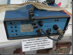
They still had the original short wave radios that they used until they got the satellite. Now the children can see their teacher and each other, though the video is under the control of the teacher.

Following that I went to the Katherine Museum which was moderately interesting with information about the growth of Katherine (basically started with the Telegraph Station at Knotts Crossing but expanded massively during WWII), the development of transport, railway and a whole room devoted to the flying doctor – not the RFDS but a local doctor who flew his own plane to treat people in remote areas. He sounded like one of these disastrous adventurers who was a danger to themselves and everyone around them but he was obviously well respected (he crashed at least four planes).

170605 031 Katherine Museum170605 015 Katherine Museum170605 016 Katherine Museum170605 022 Katherine Museum170605 026 Katherine Museum170605 028 Katherine Museum

After lunch went to Knotts Crossing where there is a weir and shallow crossing across the Katherine River used before the low level bridge was built. It was also the original site of the settlement.

170605 032 Katherine Knotts Crossing170605 034 Katherine Knotts Crossing170605 036 Katherine Knotts Crossing

Finally Dogs Head Rock(?)

170605 042 Katherine Dogs Head Rock170605 039 Katherine Dogs Head Rock

4th June 2017–Timber Creek to Katherine

Distance: 321 km
Fuel: 35 L

Another easy drive through varied scenery but a lot skirting or cutting through ranges. Ignored the 130kph speed limit and stuck to my now self imposed 100kph limit. Only overtaken half a dozen times and most of them were not travelling at 130kph judging by the time it took them to pull ahead (one maybe).

IMG_0936IMG_0939IMG_0940IMG_0941Img_0942

Stopped several times during the trip otherwise I would have arrived at some ridiculous hour; as it was I still arrived at a caravan park about 1pm. The park I chose was about 5km outside town which might have been fortunate because one I passed one near the centre of town had a queue of five caravans outside waiting to check in.

I was in Katherine only last year on my Darwin trip and spent several days looking at the sights so am probably only staying one night.

Spend a lot of the afternoon trying to work out rough distances I need to travel each day to see what I want to see and still get back home within the approximate deadline I have set for myself. I want to revisit the Undarra Lava tubes but from now on I am largely in familiar territory. I am only allowing two days to get from the Qld border to home which should be do-able but it is a long drive each day. I just don’t fancy sitting outside in the NSW winter.

The temperature at the moment is just over 30’C during the day and about 20’C at night – it suits me perfectly.

3rd June 2017–Kununurra to Timber Creek

Distance: 281 km
Fuel: 27.93 L

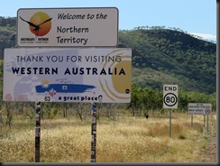
After 20 minutes driving from Kununurra crossed into the NT and lost 1.5 hours of my life.

170603 004 WA NT Border

Note the sign telling you that the maximum speed limit in the Northern Territory is 110kph – about 200 metres down the road was a 130kph speed limit sign (someone must have forgotten to remove the first sign when the NT went back to its old limits).

Driving was easy on a fairly good road through undulating bush.  I made a few stops at things that interested me.

170603 007 Kanunurra to Timber Creek170603 009 Gregory's Tree170603 013 Bradshaws Bridge170603 015 Bradshaws Bridge

Was undecided whether to stop at Timber Creek or push on another 90km to Victoria River. I stopped for a few sights along the way and it was after 1pm by the time I arrived at Timber Creek so I booked a night.

While I waited to book in I enjoyed a bloke going rabid about paying $1.70 for a two day old copy of the NT News (paper) the girl behind the counter was trying to explain that this was a remote location and the newspapers were always a couple of days old. He only wanted to pay $1.40 for it – how he arrived at that figure I don’t know but he was very insistent. He eventually flounced out but rather spoilt the flounce by having to come back to get his money back.

Unhooked my trailer in a nice shady spot and went to see the local sights having seen a couple of signs indicating lookouts as I drove in.

170603 019 Timber Creek170603 016 Timber Creek170603 023 Timber Creek170603 024 Timber Creek170603 028 Timber Creek170603 034 Timber Creek

The road in the last picture is the highway from Timber Creek to Katherine (only 290km away).

In the creek and bush at the bottom of the caravan park were some freshwater crocs, turtles, kites and bats. Actually there was a two metre croc (as big as the males get) on the bank when I first walked down but I thought it was a fibreglass garden ornament and walked within a metre of it,  it didn’t move. It was only later when I went back and found it gone that I realised it was the real thing.

170603 041 Timber Creek Freshwater Crocs170603 044 Timber Creek Freshwater Crocs170603 048 Timber Creek Freshwater Crocs170603 069 Timber Creek Freshwater Crocs170603 071 Timber Creek Bats170603 077 Timber Creek Kites

Power for this town is generated locally at a small diesel power station.

170603 078 Timber Creek Hotel Fees

I could do without the power I suppose except I like a cup of tea and some toast, videos and my music (am listening to Captain Beefheart as I type).

2nd June 2017–The Bungle Bungles

Distance: 1.5 km

Another brilliant day… Was standing outside the caravan park at 8.10pm when the little bus picked me up to go to Kununurra airport. At the airport we were briefed on where we would be flying and the day’s schedule. The flight was due to leave at 9am so we didn’t have long to wait before we board.

170602 002 Bungle Bungle Tour Plane

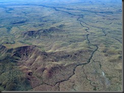
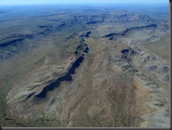
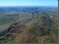
The flight to the Bungle Bungles airstrip at Bellburn took about one hour and flew down the western side of Lake Argyle (the lake is far more impressive from the air than from a boat), over a couple of cattle station homesteads before reaching the Bungle Bungles.

170602 009 Bungle Bungle Tour Elephant Rock170602 016 Bungle Bungle Tour170602 024 Bungle Bungle Tour Lake Argyle170602 030 Bungle Bungle Tour

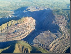
Those rectangles (above) are the tailings dams from an abandoned alluvial diamond mine. It took this mine a year to produce the amount of diamond that the Argyle Diamond Mine produces in a week.

170602 033 Bungle Bungle Tour170602 038 Bungle Bungle Tour170602 041 Bungle Bungle Tour170602 045 Bungle Bungle Tour170602 051 Bungle Bungle Tour170602 062 Bungle Bungle Tour

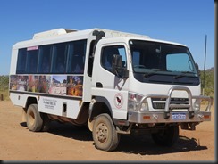
At the airstrip we were met by a 4 wheel drive truck to take us the 10km drive to Piccaninny Creek Carpark and the start of the walk into Cathedral Gorge.

170602 091 Bungle Bungle Tour Coach

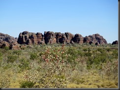
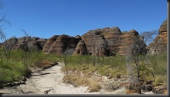
The beehive shaped mountains have red and black stripes where the blonde coloured sandstone has either reacted with algae to form the dark colour or the iron has oxidised to form the red. When you find a flake of the surface rock the colour is only as thick as a fingernail over the underlying yellow sandstone. This coating protects the rock and slows down erosion.

Millions of years ago these northern ranges were as high as the Himalayas, in 30 million more years they will be gone and northern Australia will be a coastal plain.

170602 080 Bungle Bungle Tour170602 090 Bungle Bungle Tour170602 096 Bungle Bungle Tour170602 102 Bungle Bungle Tour170602 104 Bungle Bungle Tour170602 108 Bungle Bungle Tour Cathedral Gorge Walk170602 114 Bungle Bungle Tour Cathedral Gorge Walk

The guide took us on a slight detour to see where the Qantas ad was filmed in Piccaninny Creek.

170602 118 Bungle Bungle Tour Cathedral Gorge Walk

The walk is only about 1.5km to get to the gorge but the path is very uneven and is often just soft, dry sand (it was hard to walk on).

170602 096 Bungle Bungle Tour170602 102 Bungle Bungle Tour170602 104 Bungle Bungle Tour170602 108 Bungle Bungle Tour Cathedral Gorge Walk170602 114 Bungle Bungle Tour Cathedral Gorge Walk170602 126 Bungle Bungle Tour Cathedral Gorge Walk170602 128 Bungle Bungle Tour Cathedral Gorge Walk170602 130 Bungle Bungle Tour Cathedral Gorge Walk170602 157 Bungle Bungle Tour Cathedral Gorge Walk170602 139 Bungle Bungle Tour Cathedral Gorge Walk

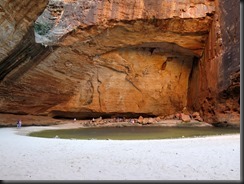
The Cathedral Gorge is immense and the acoustics are unbelievable. It was so cool and an incredible place to sit, relax and have the packed lunch provided for us.

170602 143 Bungle Bungle Tour Cathedral Gorge Walk170602 152 Bungle Bungle Tour Cathedral Gorge Walk170602 149 Bungle Bungle Tour Cathedral Gorge Walk

After hiking back to the carpark we were driven to the company’s Savannah Lodge for afternoon tea.

170602 158 Bungle Bungle Tour Cathedral Gorge Walk170602 163 Bungle Bungle Tour Cathedral Gorge Walk

After cake, biscuits and tea it was time to return to the airstrip for the flight back to Kununurra which included passing over the massive Argyle Diamond Mine.

170602 180 Bungle Bungle Tour170602 183 Bungle Bungle Tour170602 195 Bungle Bungle Tour170602 210 Bungle Bungle Tour170602 224 Bungle Bungle Tour170602 227 Bungle Bungle Tour

The plane landed at about 5pm so it was a pretty full day.

170602 251 Bungle Bungle Tour Plane

BTW I remembered to count the seats on this plane – there are 12 plus the seat beside the pilot.

1st June 2017–Kununurra Day One

Distance: 4 km
Fuel: 33 L

Up before 6am presumably because, being on the edge of a time zone, the sun rises unreasonably early. Anyway I showered, washed yesterday’s clothes, had brekkie etc while most people were still asleep.

170601 003 Kununurra Town Caravan Park

At a far more reasonable hour drove into town to the Visitor’s Centre where a helpful lady booked me on a flight to the Bungle Bungles with a walking tour of Cathedral Gorge. Pretty pleased with that, there is also a chance of a helicopter ride when I get there (hoping and clutching my credit card). Actually I thought it was another seaplane ride but reading the brochure it is a normal plane and we land on a dirt airstrip in the National Park.

While I was in the shopping centre I also bought, wrote and sent postcards to all the usual suspects as I had a coffee and a vanilla slice (haven’t had a vanilla slice for years).

As I will be away all day tomorrow filled the car up with fuel too.

The main event today was a cruise on Lake Argyle; the bus picked me up at 1pm and drove half a dozen of us to the lake. On the way it stopped for 15 minutes at the Argyle Downs homestead. This was the original house built by the Durack family when they first started grazing in the region in the mid 1800s. It was dismantled when the property was to be flooded by the dam and rebuilt on higher ground.

170601 009 Argyle Homestead170601 013 Argyle Homestead170601 010 Argyle Homestead

The cruise itself was so so. Everybody else seemed to enjoy it but personally I thought it was a bit dull, no dolphins just a few freshwater crocs, some short eared wallabies, the odd wallaroo and lots of water. The dam wall itself is made of locally quarried rocks and clay there is no concrete except in the pump towers.

170601 051 Lake Argyle Cruise

170601 075 Lake Argyle Cruise170601 026 Lake Argyle Cruise Short Eared Wallaby170601 037 Lake Argyle Cruise170601 042 Lake Argyle Cruise Walleroo170601 054 Lake Argyle Cruise170601 062 Lake Argyle Cruise Fresh Water Crocodile170601 066 Lake Argyle Cruise Fresh Water Crocodile170601 072 Lake Argyle Cruise170601 080 Lake Argyle Cruise170601 089 Lake Argyle Cruise170601 115 Lake Argyle Cruise Sunset170601 118 Lake Argyle Cruise Sunset

Just before sunset some of the passengers went swimming in the lake, the water temperature is 26’C.

There was one redeeming feature – two cans of free beer. Yes, I know it is me but cruises and water don’t excite me much.

Statistics

It has been six weeks since I started on this trip so time for some statistics (you know… those things made up on the spur of the moment) rounded to the nearest whole number.

Total Distance travelled: 10995 km
Fuel Used: 1099 litres
Fuel Cost: $1510
Accommodation Cost: $1384

31st May 2017–Warmun to Kununurra

Distance: 332 km

Was in two minds whether to go to Wyndham or Kununurra today but I was ready to leave very early (7.30am) so decided to go to Wyndham for a look then continue on to Kununurra.

The journey to Wyndham was through a series of interesting ranges and winding passes.

170531 001 Ranges Near Kununurra170531 006 Ranges Near Kununurra170531 008 Ranges Near Kununurra

Just outside Wyndham is an area called The Grotto which is a hole in the ground with very dodgy looking stairs.

170531 012 WyndhamThe Grotto170531 014 WyndhamThe Grotto170531 015 WyndhamThe Grotto170531 018 WyndhamThe Grotto170531 022 WyndhamThe Grotto170531 023 WyndhamThe Grotto

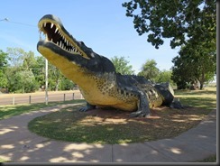
Wyndham has a Big Croc…

170531 028 Wyndham Big Crocodile

I did want to go to the Five Rivers Lookout BUT there was a sign which said, “No Caravans” so that was that.

Kununurra is only 70km from Wyndham so it was an easy drive. Found a caravan park right in the centre of town where I booked in for a few nights and also booked a cruise on Lake Argyle for tomorrow arvo. There is a dinner cruise on Lake Kununurra but I think I have eaten enough Barramundi for a while.

After setting up my camp including my gazebo and doing my laundry I went for a drive. First stop the Kellys Knob Lookout with its views over town.

170531 036 Kununurra Kellys Knob170531 040 Kununurra Kellys Knob170531 049 Kununurra Kellys Knob170531 053 Kununurra Kellys Knob

Then it was down to Celebrity Park and Lake Kununurra.

170531 055 Kununurra Lake Kununarra and Celebrity Park170531 057 Kununurra Lake Kununarra and Celebrity Park170531 063 Kununurra Lake Kununarra and Celebrity Park170531 064 Kununurra Lake Kununarra and Celebrity Park

Lake Argyle and Lake Kununurra are part of the failed Ord River scheme. I have read the signs but still have only the vaguest notion of why the scheme needed two separate dams so you will have to Google it.

When the sun went down I was feeling pretty hungry so I wandered into the town centre looking for a restaurant and eventually found an Asian one opposite a Subway when I had almost given up. The meal wasn’t bad at all but I think I need to do better preparation in future; wandering about in strange towns is not the best way to find a feed.

Kununurra is only about 40km from the WA/NT border. The next town is Katherine on the Stuart Highway 500km and a time zone away.

30th May 2017–Fitzroy Crossing to Warmun

Distance: 468 km
Fuel: 55 L

This morning, before packing up, I went for a drive to the old Fitzroy Crossing. It is still there but the river silt either side has effectively blocked it off. There were some tyre tracks but they had come from the river sand flats. It is still only a metre above the water line now so one can understand why it was replaced by a higher level bridge.

170530 015 Old Fitzroy Crossing170530 004 Old Fitzroy Crossing170530 008 Old Fitzroy Crossing170530 009 Old Fitzroy Crossing

The drive to Halls Creek where I had originally intended to stay was pretty straight forward though there were many single lane bridges on the way which had to be approached with some caution.

170530 017 Near Halls Creek

At Halls Creek I filled up with fuel but because it was only 10.30am decided to press on to Warmun (Turkey Creek) Roadhouse only another 160km further on. Warmun is a small Aborigine community who own and run the roadhouse.

At Warmun I enquired about a site and was told to take one and come back to tell them which site it was – it was $35 for a powered site. Once I had set up I wandered over to the Helicopter Flight office and asked if there were anybody who wanted a flight but needed another to make up the numbers. Oh dear, nothing looking likely and at $400 per person I wasn’t going to pay for two seats. Will try again in the morning because Kununurra is only 200km away.

170530 022 Warmun Roadhouse170530 029 Warmun Roadhouse

What was an almost empty caravan park was nearly full by the time 6pm came round.

170530 025 Warmun Roadhouse

29th May 2017–Derby to Fitzroy Crossing

Distance: 308km
Fuel: 58 L

Was out early buying fuel for the journey to Fitzroy Crossing and was on the road by 7.45am.

Easy drive to Fitzroy Crossing  where I arrived about 11am. Found a Caravan Park right next to the IGA store, Checked in and the lady told me that there was a boat tour at the Geikie Gorge at 4pm.

The Geikie Gorge is only just over 20km from town and that sounded a good idea so at about 1pm I took off for the Geikie Gorge National Park. Of course I arrived in plenty of time for the boat trip, originally I had intended to suss it out and return later but there were a number of walks at the park so I decided to try out a couple – I was carrying plenty of water in the car.

History: Geikie Gorge is a reef from the Devonian Period (250 million years ago?) when the area was a sea. As I understand it it is limestone from a combination of algae and coral.

Anyway my first walk was in among the reef formations. BTW this is a story where too many rocks are just not enough.

170529 006 Fitzroy Crossing Geikie Gorge NP170529 008 Fitzroy Crossing Geikie Gorge NP170529 013 Fitzroy Crossing Geikie Gorge NP170529 015 Fitzroy Crossing Geikie Gorge NP170529 022 Fitzroy Crossing Geikie Gorge NP

Then it was a walk along the side of the Fitzroy River to the sandbar and the Margaret River. (In case you haven’t working it out yet Fitzroy Crossing is so named because it was a place early settlers could get across the Fitzroy River).

170529 035 Fitzroy Crossing Geikie Gorge NP170529 038 Fitzroy Crossing Geikie Gorge NP

Here you can see both the start of the sandbar and where the Margaret River joins the Fitzroy to the left of the sandbar.

170529 041 Fitzroy Crossing Geikie Gorge NP170529 044 Fitzroy Crossing Geikie Gorge NP

These were not arduous walks being about a kilometre or so each but the path was mainly soft sand (silt from the river flood) which made it hard going. They were well marked.

Suddenly it was time for the boat trip…

170529 055 Fitzroy Crossing Geikie Gorge NP Boat Trip

170529 056 Fitzroy Crossing Geikie Gorge NP Boat Trip

170529 069 Fitzroy Crossing Geikie Gorge NP Boat Trip170529 061 Fitzroy Crossing Geikie Gorge NP Boat Trip170529 070 Fitzroy Crossing Geikie Gorge NP Boat Trip170529 073 Fitzroy Crossing Geikie Gorge NP Boat Trip170529 075 Fitzroy Crossing Geikie Gorge NP Boat Trip170529 078 Fitzroy Crossing Geikie Gorge NP Boat Trip170529 079 Fitzroy Crossing Geikie Gorge NP Boat Trip170529 081 Fitzroy Crossing Geikie Gorge NP Boat Trip170529 084 Fitzroy Crossing Geikie Gorge NP Boat Trip170529 094 Fitzroy Crossing Geikie Gorge NP Boat Trip170529 102 Fitzroy Crossing Geikie Gorge NP Boat Trip170529 108 Fitzroy Crossing Geikie Gorge NP Boat Trip

These are birds nests made of mud and saliva stuck to the underside of overhanging rocks.

170529 112 Fitzroy Crossing Geikie Gorge NP Boat Trip170529 115 Fitzroy Crossing Geikie Gorge NP Boat Trip170529 117 Fitzroy Crossing Geikie Gorge NP Boat Trip170529 124 Fitzroy Crossing Geikie Gorge NP Boat Trip170529 136 Fitzroy Crossing Geikie Gorge NP Boat Trip170529 141 Fitzroy Crossing Geikie Gorge NP Boat Trip170529 149 Fitzroy Crossing Geikie Gorge NP Boat Trip170529 150 Fitzroy Crossing Geikie Gorge NP Boat Trip

The dark areas of the rocks are oxidised limestone while the light areas show where the river comes to at its peak. The limestone is eroded and scoured by the river. The ranger’s pagoda roof has been under 2 metres of water and it is not an insubstantial structure perhaps 5 metres high and many metres above the current water level.

The crocs are Freshwater Crocodiles much smaller and less threatening than the Salties further north, the river is quite safe to swim in they don’t attack humans.
This rock island is sacred to the local aborigines and is the only place where swimming is not allowed.

170529 093 Fitzroy Crossing Geikie Gorge NP Boat Trip

The boat trip finished just as the sun set so the drive back to town was at my least favourite time of day (for driving). As it happened I had to stop several times for wallabies with all the road sense of a two year old but I didn’t hit anything and got back safely.

I decided I didn’t want to cook so I went looking for a restaurant… Nope! the only food was at the servo but I really wanted a meal so I just bought fuel for tomorrow.

The diesel here is $1.43/L compared to $1.52 at Derby – how does that work?

28th May 2017–Derby

Distance: 21 km

Today I exhausted the charms of Derby. I had to wait for the park shop to open for me to buy ice but once that was done I set off.

First stop the Visitors’’ Centre where I parked the car and followed the Heritage Walk Guide. It was a typical self guided town walk a mixture of what had been but was gone, a brief town history and an explanation of what still remained. It passed a pleasant hour or so in the cool of the morning.

There were the Boab Trees down the main street.170528 006 Derby

The propeller and anchor of a ship, SS Colac, that was damaged and sank at the wharf in 1910.

170528 001 Derby170528 004 Derby170528 003 Derby

The Derby Museum.

170528 009 Derby Museum

The Old Woolshed and Tramway restoration project.

170528 012 Derby Woolshed

170528 014 Derby Woolshed and Tramway

Finally the Derby Picture Gardens a once typical bush open air cinema, alas only the screen remains.170528 020 Derby Picture Gardens

By now I was a bit peckish so I called in at the Jila Gallery Cafe for coffee and cheesecake.

Finally back at my starting point I decided to revisit the wharf because I had missed the Centenary Mosaic when I visited yesterday.

170528 035 Derby Centenary Mosaic170528 036 Derby Centenary Mosaic

The tide was out so the tidal mud flats were visible.

170528 037 Derby Wharf Mangroves170528 040 Derby Wharf Mangroves

I drove to Derby’s Old Gaol next to the Police Station. What an awful place it must have been, just a cage with a tin roof and rings in the floor for attaching chains, No toilets. Terrible!
The original  Police Station is long gone having been eaten by termites but even termites didn’t like the steel cage.170528 027 Derby Old Gaol170528 028 Derby Old Gaol

Finally I was out walking looking for lunch when I came across this hollow Boab tree which was just part of the streetscape. From one side it looked a healthy solid Boab from the other it was a different matter.

170528 042 Derby Hollow Boab170528 044 Derby Hollow Boab170528 045 Derby Hollow Boab